How Do I Get To Point B? Well, Spatial Data Can Help.
When you ask your map program (Google maps for example) to help you navigate from point A to point B, it turns around and asks a hidden treasure trove of information commonly referred to as spatial data, also known as geospatial data or geographic information. This wizard of geography, a kind of Oz behind the scenes, is able to identify the geographic location of features and boundaries on Earth, from oceans to bridges and more.
Usually stored as coordinates and topology, this is data that can be mapped. It’s often accessed, manipulated, or analyzed through Geographic Information Systems (GIS), which is what we use to ask our question: How do I get to point B?
Great, Spatial Data is Smart, But What Good Is It If It Can’t Talk?
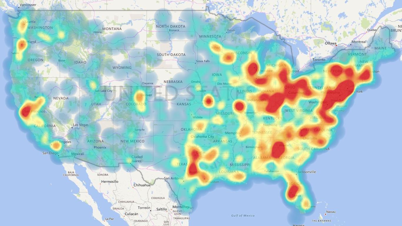
Actually, spatial data can communicate … through images! Small sections of map data, cataloged as “tiles,” are strung together to form a picture on your screen. This is true whether you are viewing a satellite map, a road-type map, or a street-view map.
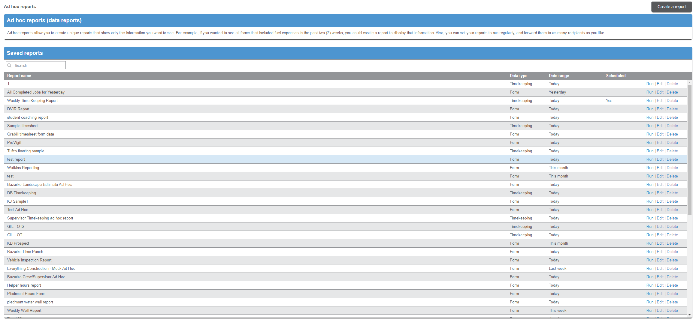
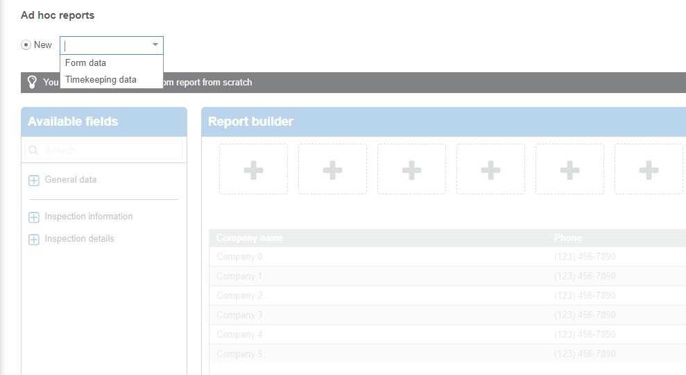
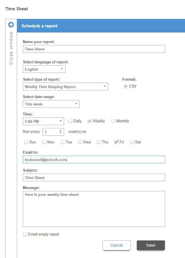
How Actsoft Brings You This Technology
Actsoft works with some of the most respected leaders in the tech industry who specialize in geocentric products. These partnerships afford Actsoft the ability to stay ahead of the tech trends, thereby bringing our customers the latest developments. We’re also able to manage our spending where it matters: development and customer support. See below for a couple of examples of how our strategic partnerships work to offer the highest quality product while maximizing every dollar and giving our customers the richest software solutions experience on the market today.
Navteq and Actsoft
Navteq Inc., one of Actsoft’s partners, provides the constantly updated map data seen in Actsoft products. To make access faster for its customers, Actsoft hosts the large majority of the road map tiles on huge storage capacity Geo-Servers in a secure facility near Tampa, Florida. The satellite view mapping tiles, though, are accessed directly from Navteq Servers.
Telogis and Actsoft
Another partner, Telogis Inc., developed software for the Actsoft’s Geo-Servers. The software utilizes a Geobase File System (GBFS) structure to store this data in a compressed format, lowering the amount of actual space required to hold the massive number of tiles, which includes the mapping of the entire world’s land mass. Expanding the data from this compressed format preserves the resolution of the tiles whether you are viewing a map of the United States or a portion of downtown Nashville.
The world is at our fingertips with maps and GPS, whether navigating from point A to point B or running a company monitoring routes, assets, landmarks, jobs, deliveries, and employees in a mobile-to-mobile environment within a city or across a country.
Have any questions on how Actsoft can help you?


 Actsoft partnered with Odin to provide our solutions overseas, through payment processing integrations. Odin helps us support user management for our software; customers can also purchase our products through Odin’s billing platform.
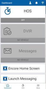
 VisTracks powers our Electronic Logging Device (ELD) solution, which enables transportation businesses to easily automate their hours of service logs, remain in governmental compliance, and reduce their potential to incur costly fines.
 Integration between Actsoft solutions and BeWhere’s software products is available. Take your team’s asset tracking, cellular data connectivity, and field insight a step further with effective, cross-application compatibility.
 CalAmp tracking devices for vehicles and assets alike are compatible with Actsoft solutions, making it easy for you to efficiently monitor your equipment and fleet cars. Help your team enhance accountability, safety, and savings through a combination of easily installed hardware and intuitive software.
 Gain even greater insight into the daily activities of your fleet using the combination of Geotab and Actsoft. Geotab devices provide detailed data collection and seamless integration with our solutions; learn more about the ways your vehicles are being used daily with the power of this tandem.
 Our partnership with Uniden is ideal for companies looking to gain advanced diagnostics on their fleets. Uniden’s extensive product listing of car electronics like radios, dash cams, radar detectors, and in-vehicle communicators work in concert with Actsoft’s solutions to better connect your vehicles to the company headquarters.
 Kyocera offers a wide range of mobile devices, ranging in design from traditional phones to ultra-durable handset technology. Actsoft is able to equip organizations in a variety of different industries with solutions for improved business, while Kyocera supplies the technology they can flawlessly operate on.
 Motorola’s mobile technology works in tandem with our solutions to provide extra versatility to your business practices. Coupled with our software’s features, Motorola’s reliable devices make connecting your workforce simpler than ever to do.
 Actsoft and Sanyo teamed up to merge intuitive business management software with the technology of today. This partnership allows us to provide you with all the tools your team needs for improved workflows, better coordination, and optimized productivity.
 We’re able to bundle certain solutions of ours (including our Electronic Visit Verification options) with Samsung devices to help your team achieve as much functionality as possible, while keeping rates affordable. Use these combinations for accurate recordkeeping, improved communication, and smarter data collection in the field.
 Our software is the perfect complement to Apple’s user-friendly technology. Equip your workforce with the devices and solutions it needs for optimized productivity during daily operations with Apple and Actsoft.